
Slika:Maastricht-topografie.jpg

Velikost tega predogleda: 567 × 600 točk. Druge ločljivosti: 227 × 240 točk | 454 × 480 točk | 726 × 768 točk | 968 × 1.024 točk | 1.759 × 1.860 točk.
Izvorna datoteka (1.759 × 1.860 točk, velikost datoteke: 2,31 MB, MIME-vrsta: image/jpeg)
Spodaj prikazane informacije so s tamkajšnje opisne strani.
Povzetek
| Opis |
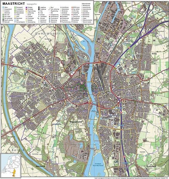
Nederlands: Topografisch beeld van de stad Maastricht.
Op basis van de GML open geodata van de BRT/Top10NL (basisregistratie Topografie, Kadaster 2012), vrijgegeven door Kadaster op 30-11-2012 onder de Creative Commons BY licentie. Gebouwvlakken vanuit Open Geodata BAG extract (december 2012). Samenstelling en kleurenschema: Jan-Willem van Aalst, met QuantumGIS en Photoshop. |
| Datum | |
| Vir | lastno delo |
| Avtor | Janwillemvanaalst |
Licenca
Jaz, imetnik avtorskih pravic na tem delu, ga objavljam pod naslednjo licenco:
Datoteka je objavljena pod licenco Creative Commons Priznanje avtorstva-Deljenje pod enakimi pogoji 3.0 Brez predelav.
- Dovoljeno vam je:
- deljenje – reproducirati, distribuirati in javno priobčevati delo
- predelava – predelati delo
- Pod naslednjimi pogoji:
- priznanje avtorstva – Navesti morate ustrezno avtorstvo, povezavo do licence in morebitne spremembe. To lahko storite na kakršen koli primeren način, vendar ne na način, ki bi nakazoval, da dajalec licence podpira vas ali vašo uporabo dela.
- deljenje pod enakimi pogoji – Če boste to vsebino predelali, preoblikovali ali uporabili kot izhodišče za drugo delo, morate svoj prispevek distribuirati pod enako ali združljivo licenco, kot jo ima izvirnik.
Zgodovina datoteke
Kliknite datum in čas za ogled datoteke, ki je bila takrat naložena.
| Datum in čas | Sličica | Velikost | Uporabnik | Komentar | |
|---|---|---|---|---|---|
| trenutno | 09:58, 14. januar 2013 | | 1.759 × 1.860 (2,31 MB) | Janwillemvanaalst | Added various topographic improvements, which were already available in the BRT open-geodata source files: - Symbols for special physical appearances of land types such as "swampy terrain" - Symbol for carpool parking + large open parking spaces (in ad... |
| 21:37, 5. januar 2013 |  | 1.759 × 1.860 (2,26 MB) | Janwillemvanaalst | Various rendering improvements, following the advice of several topographic experts. Scale remains unchanged. | |
| 15:10, 30. december 2012 |  | 1.759 × 1.860 (2,17 MB) | Janwillemvanaalst | Map redrawn using updated (Dec. 2012) open geodata Dutch government base registries BRT + BAG. Rendered using QuantumGIS and Photoshop. | |
| 14:40, 17. februar 2012 |  | 2.263 × 2.196 (2,53 MB) | Janwillemvanaalst |
Uporaba datoteke
Datoteka je del naslednje 1 strani slovenske Wikipedije (strani drugih projektov niso navedene):