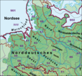
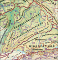
Slika:Naturraeumliche Grossregionen Deutschlands plus.png
Videz

Velikost tega predogleda: 472 × 599 točk. Druge ločljivosti: 189 × 240 točk | 378 × 480 točk | 605 × 768 točk | 807 × 1.024 točk | 1.827 × 2.318 točk.
Izvorna datoteka (1.827 × 2.318 točk, velikost datoteke: 6,48 MB, MIME-vrsta: image/png)
Zgodovina datoteke
Kliknite datum in čas za ogled datoteke, ki je bila takrat naložena.
| Datum in čas | Sličica | Velikost | Uporabnik | Komentar | |
|---|---|---|---|---|---|
| trenutno | 23:36, 23. december 2020 |  | 1.827 × 2.318 (6,48 MB) | Elop | |
| 22:07, 23. december 2020 |  | 1.827 × 2.318 (6,48 MB) | Elop | ||
| 19:53, 25. december 2014 |  | 1.827 × 2.318 (6,53 MB) | Elop | Lößbörden korr. (533), insbesondere Grenzverlauf; Vorland des Thüringer Waldes (380) strittige Naturräume mit Nummern | |
| 14:42, 22. november 2014 |  | 1.827 × 2.318 (6,52 MB) | Elop | Korrekturen im Norden: Statt "Ems-Weser-Geest" und "Nordelbische Geest" zusammenfassend "Norddeutsche"; Lüneheide und Meckerplatte als sehr bekannte Landschaften beschriftet; dicke Linie zwischen Erst- und Zweitgenannter gedünnt, Außenlinie von 87 a... | |
| 14:46, 2. julij 2012 |  | 1.827 × 2.318 (6,52 MB) | Elop | k | |
| 22:29, 1. julij 2012 |  | 1.827 × 2.318 (6,52 MB) | Elop | k | |
| 16:08, 1. julij 2012 |  | 1.827 × 2.318 (6,52 MB) | Elop | k | |
| 23:44, 30. junij 2012 |  | 1.827 × 2.318 (6,49 MB) | Elop | Update; insbesondere Alpen komplett neu; alle Pfade neu nachgezeichnet und korrigiert, auch außerhalb Dlands; NNWs Karte damit vektoriell erneuert | |
| 15:31, 27. maj 2012 |  | 1.827 × 2.318 (6,5 MB) | Elop | Update | |
| 01:25, 25. oktober 2011 |  | 1.827 × 2.318 (6,49 MB) | Elop | k |
Uporaba datoteke
Datoteka je del naslednje 1 strani slovenske Wikipedije (strani drugih projektov niso navedene):
Globalna uporaba datoteke
To datoteko uporabljajo tudi naslednji vikiji:
- Uporaba na cs.wikipedia.org
- Uporaba na de.wikipedia.org
- Mittelgebirge
- Norddeutsches Tiefland
- Liste der Landschaften in Bayern
- Mittelgebirgsschwelle
- Naturräume in Sachsen
- Naturräumliche Großregionen Deutschlands
- Naturraum
- Portal:Umwelt- und Naturschutz/Artikel des Monats
- Diskussion:Mitteldeutschland/Archiv/1
- Benutzer:Frze
- Benutzer Diskussion:Elop/Archiv 2011
- Wikipedia:WikiProjekt Geographie/Projekt Naturräumliche Gliederung Mitteleuropas
- Vorlage:Positionskarte Deutschland Naturraum
- Vorlage Diskussion:Positionskarte Deutschland Naturraum
- Benutzer:Elop/Galerie/Karten
- Nordbrandenburgisches Platten- und Hügelland
- Mittelbrandenburgische Platten und Niederungen
- Uporaba na en.wikipedia.org
- Uporaba na es.wikipedia.org
- Uporaba na fr.wikipedia.org
- Uporaba na no.wikipedia.org
- Uporaba na pl.wikipedia.org
- Uporaba na pl.wiktionary.org
- Uporaba na ru.wikipedia.org
- Uporaba na www.wikidata.org


